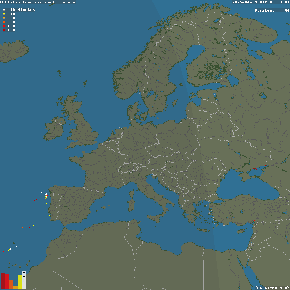
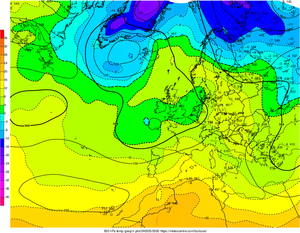
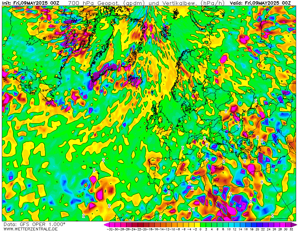
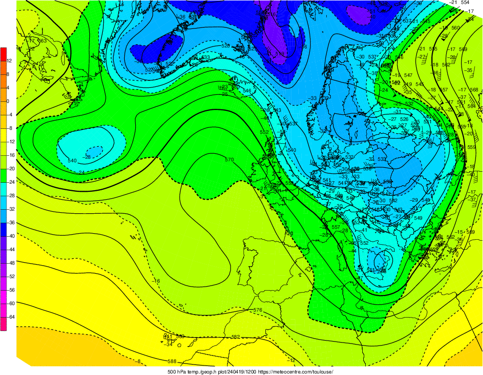
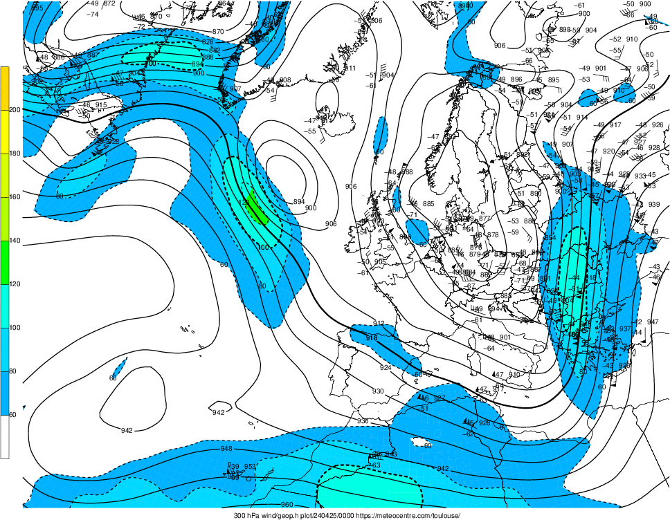
Visible Satellite.Infrared Satellite.Radar – Rain.Radar – Snow.Lightnings.Convective Available Potential Energy (CAPE, J/Kg) (red) & Lifted index (LI, °C) (blue). (Details).Surface pressure and Geopotential height at 500 hPa (Details).Surface pressure and fronts.Temperature and Geopotential height at 850 hPa (Details).Vertical motion and Geopotential height at 700 hPa (GFS model). Check other hours here.Temperature and Geopotential height at 500 hPa (Details).Jet Stream. Wind speed [knots] and Geopotential height at 300 hPa (Details).Sea surface temperature (GFS model). (Zoom: Central Mediterranean Sea).Sea surface temperature (SST) anomaly (Source). CRW’s heritage twice-weekly global 50km SST Anomaly was produced by subtracting the long-term mean SST (for that location in that time of year) from the current value (Details).Dust concentration near ground, based on SKIRON forecast (Source, details, and forecast for next days).


